The Section was formed in 1986, to encourage and enhance the appreciation of all aspects of the landscape and the way in which it reflects the social, political and economic decisions made throughout history.
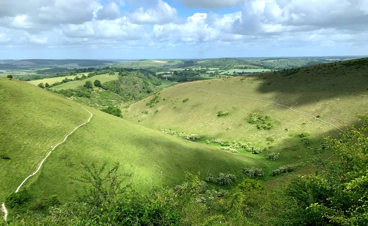
View west from Butser Hill
2026 Events:
Saturday 6th June – Walbury Hill to Inkpen Beacon
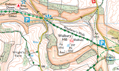
John Firth (author of ‘Geology & Archaeology of Berkshire’ (2022)) led a visit to Walbury Hill and Inkpen Beacon. The visit linked the landscape, including archaeology and the features, to the geology of this area on the border of northern Hampshire and southern Berkshire.
John gave an introduction followed by a guided walk along the ridge on the Wayfarers Walk. This area, at the boundaries of Hampshire, Berkshire and Wiltshire, has surface outcrops (from oldest to youngest) of Upper Greensand, Chalk, clays with some silts and sands of the Lambeth Group along with similar deposits of the London Clay. Evidence of underlying structures will be explained as will deposits related to former cataclysmic events. The formation of landforms, like scarps, was studied. The many and varied land uses were considered, including: Walbury Hill Fort and Inkpen Long Barrow.
Wednesday 6th May – A Walk from Crondall to the Harrow Way
The walk began at the Village Hall, Croft Lane, Crondall, Hampshire, GU10 5QF:
- Mary Porter, Crondall Society, led the walk to the Harroway by road and footpath with one steep & stoney section. The route will follow a short part of the Harroway, passing near the site of Powderham Castle and close to the site of the ‘Workhouse School’.
- Then we walked north, up a short flight of steps, to a footpath that returned back to the village. There was a loop through Barley Pound woods, where there are the remains of Barley Pound Castle. There will be excellent views of the village and surrounding area, including Horsedown Common, a geological outlier.
- On our return there was a stop at the café at the Penn Croft winery for refreshments.
- Note: the walk will be repeated in 2027.
Sat 11th April – a visit to Selborne and Selborne Common
- Chris Webb led the walk up onto Selborne Common via the Bostal path. He explained the existing landscape, including the geology, and its development since the Bronze Age. Gilbert White’s landscape was also considered though, as Chris noted, ‘There is life beyond Gilbert White’. The use of Selborne Hill as common pasture and woodland by the settlement of Selborne and its surrounding farms was explored. The existence of early field systems, discovered by Chris, were shown. The return to the village was via the Zig-Zag path.
- Lunch was enjoyed at the Selborne Arms.
- The visit continue with a walk along the High Street to the St Mary’s Church which was at the centre of the medieval development of Selborne. St Mary’s Church was founded in Saxon times, the present church with its Norman tower and nave, largely dates from 1180. Outside the church are the remains of the famous 1400 year old yew tree which was blown down in gales in January 1990.
If you have any questions, please email landscape@hantsfieldclub.org.uk.
Newsletter: The Landscape Section publishes articles in the HFC Newsletter and we welcome contributions on landscape related topics. If you have any ideas or articles for the Newsletter, please email landscape-newsletter@hantsfieldclub.org.uk to discuss your proposal.